Maps
Ted W. Walters & Associates has experienced personnel specifically dedicated to mapping projects. Our mapping team members are assigned to specific projects and work closely with our Project Managers, utilizing the latest technology and software to create any type of map our clients may require:
-
-
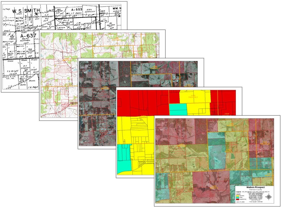
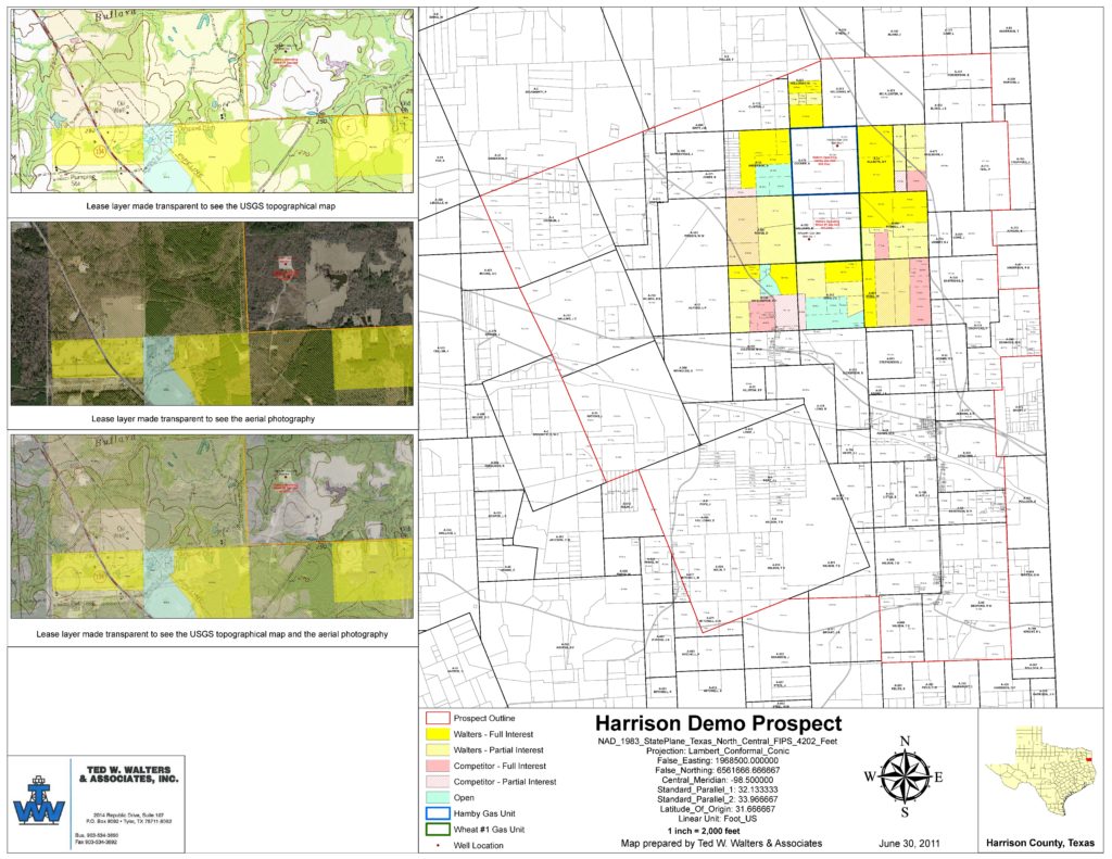
- Mineral Ownership Maps
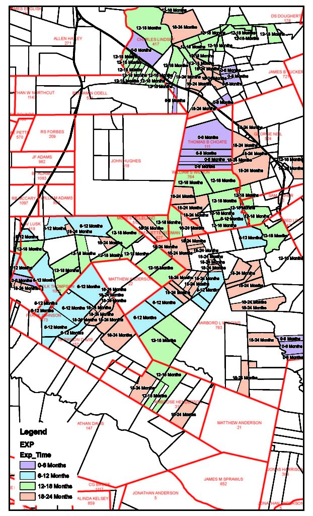
- Lease Status Maps
- Lease Expiration Maps
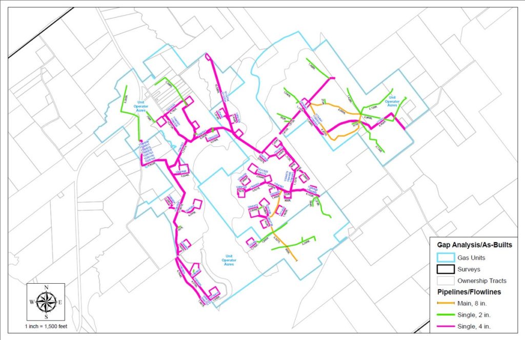
- Right-of-Way maps
- Working Interest Maps
- Competitor Leasehold Maps
- Unit Maps
- Title Tracking Maps
- Aerial View Maps (2012 where available)
- Topographical Maps
- Gap Analysis/As-Built Maps
- Any combination of the above
-
We integrate GIS and GPS coordinating systems, survey data from Tobin Maps, and scanned images to provide full service mapping for all projects. We strive to acquire and use the most current data and aerials available to enhance the maps we produce.
Our clients give us consistent high ratings on the detail, timeliness and quality of our mapping product.